GeoTrax Survey is a geophysical survey technique that provides high-resolution, two-dimensional (2D) images of the earth’s subsurface. It is analogous to a CAT Scan in the medical industry.
It is used to map geology, locate environmental contamination, target production water wells, identify potential geohazards, monitor changes over time (temporal imaging), and has other uses.
Electrical current (safe level) is injected into the ground, and the voltage is measured coming back out. Ohm's Law is used to calculate resistivity:
- Four electrodes yields one measurement data point (a “pixel”)
- Iterative measurements yield a matrix of data points, or “pixels”
- Proprietary software generates a subsurface image from the datapoints, which is similar to a digital camera taking an electrical picture of subsurface
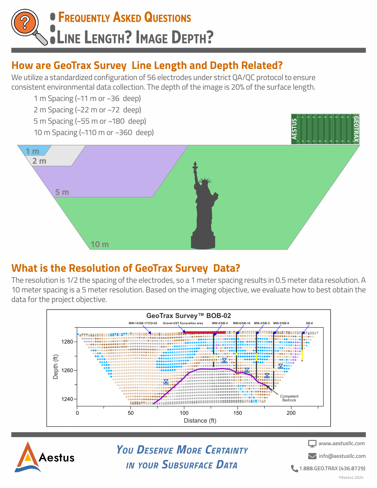
The theoretical resolution is 1/2 the spacing of the electrodes.
Example: 1- meter spacing results in a 0.5 -meter data resolution. A 10 -meter spacing results in a 5 -meter resolution.
The depth of the image is 1/5 (20%) of the length of the transect line (electrode array) on the ground surface. So a 500-foot-long transect line yields an imaging depth of 100 feet below ground surface (BGS). Based on the imaging objective depth, we evaluate how to best obtain the data for the project objective.
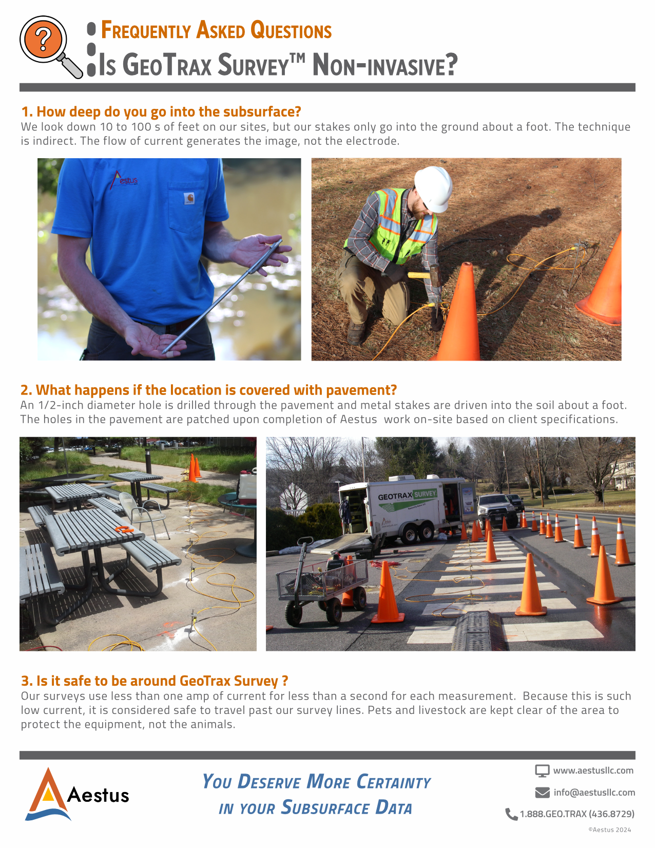
We have imaged up to 1,000 feet BGS, but our stakes only go into the ground about 12-16 inches. The technique is indirect. The flow of current generates the image, not the electrode.
We use 3/8-inch diameter stainless steel electrode stakes, which are driven into the soil typically 12-16 inches deep. Cables are connected to the electrodes and to field computers that collect the data.
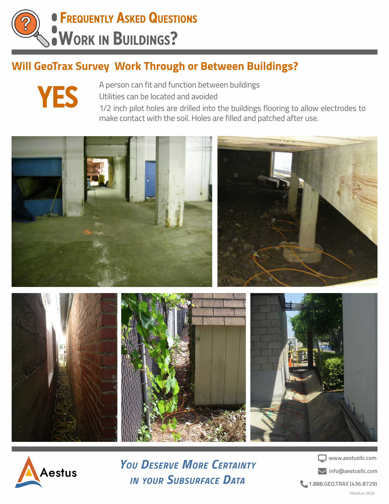
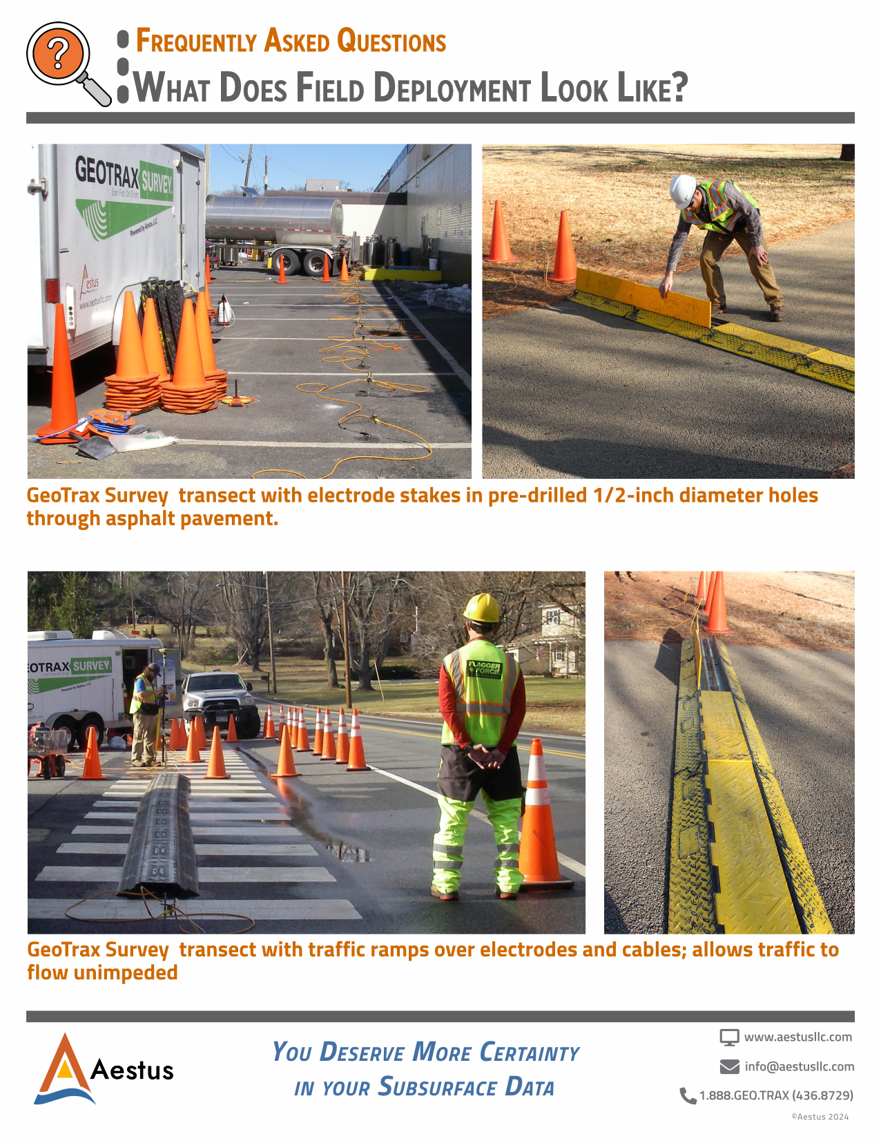
We pre drill a 1/2-inch diameter hole through the pavement such that our electrode stakes can be driven into the soil a short distance below the bottom of the pavement. We patch the holes in the pavement upon completing our work on site.
Please do not drive over our cables as this will damage them. We have traffic ramps to place over the cables and allow vehicles to cross.
We use a standard 12-volt-deep cycle marine battery as a power source. A current of ~350 milliamps is “injected” into the ground. Because this is relatively low current, it is safe for pets and people to travel past our survey lines. People should avoid contact with electrode stakes and be careful not to trip over our geophysical cables.
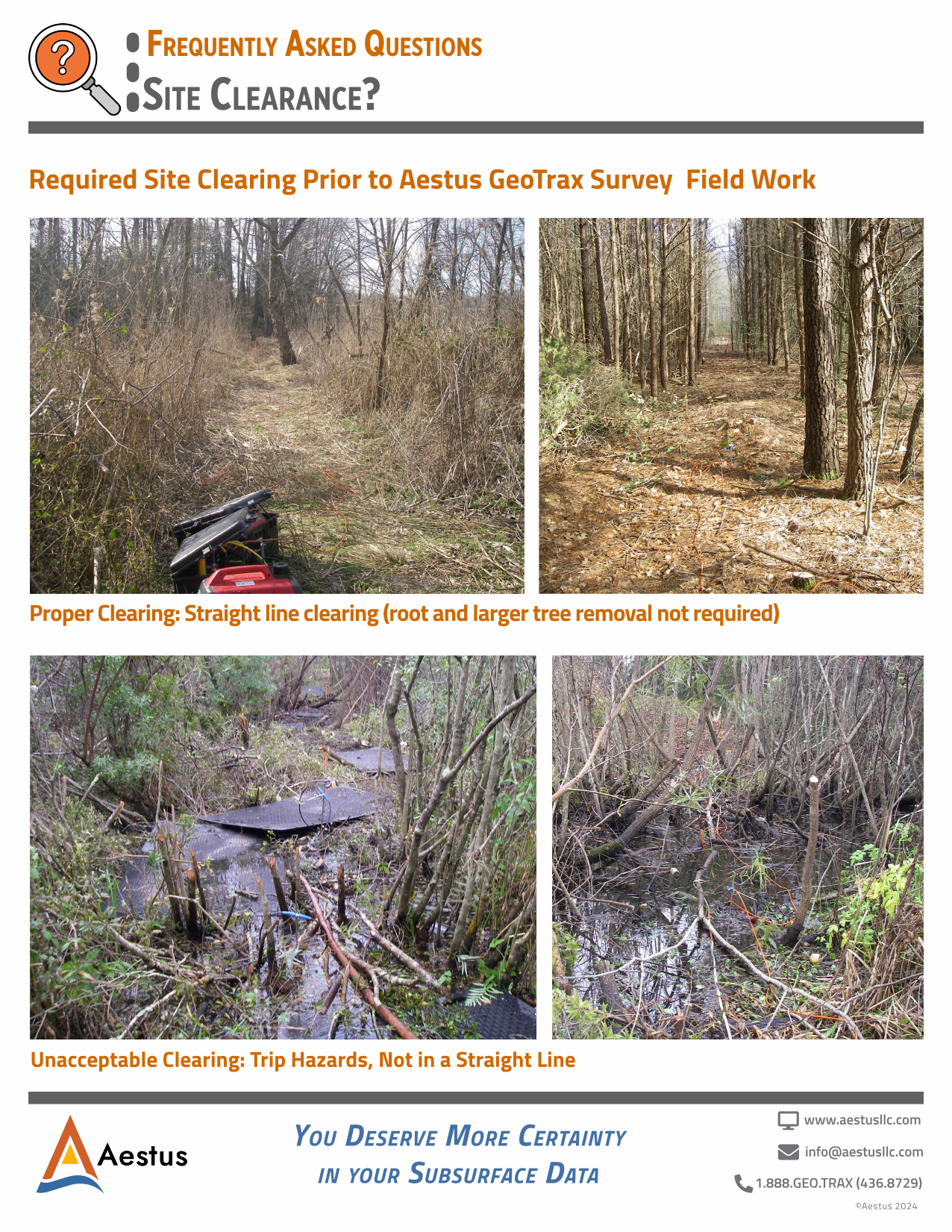
Vegetation clearing in straight lines is required prior to GeoTrax Survey field work, if dense vegetation exists. While large trees can normally stay, mitigation of trip hazards due to low lying stumps, etc., is important.
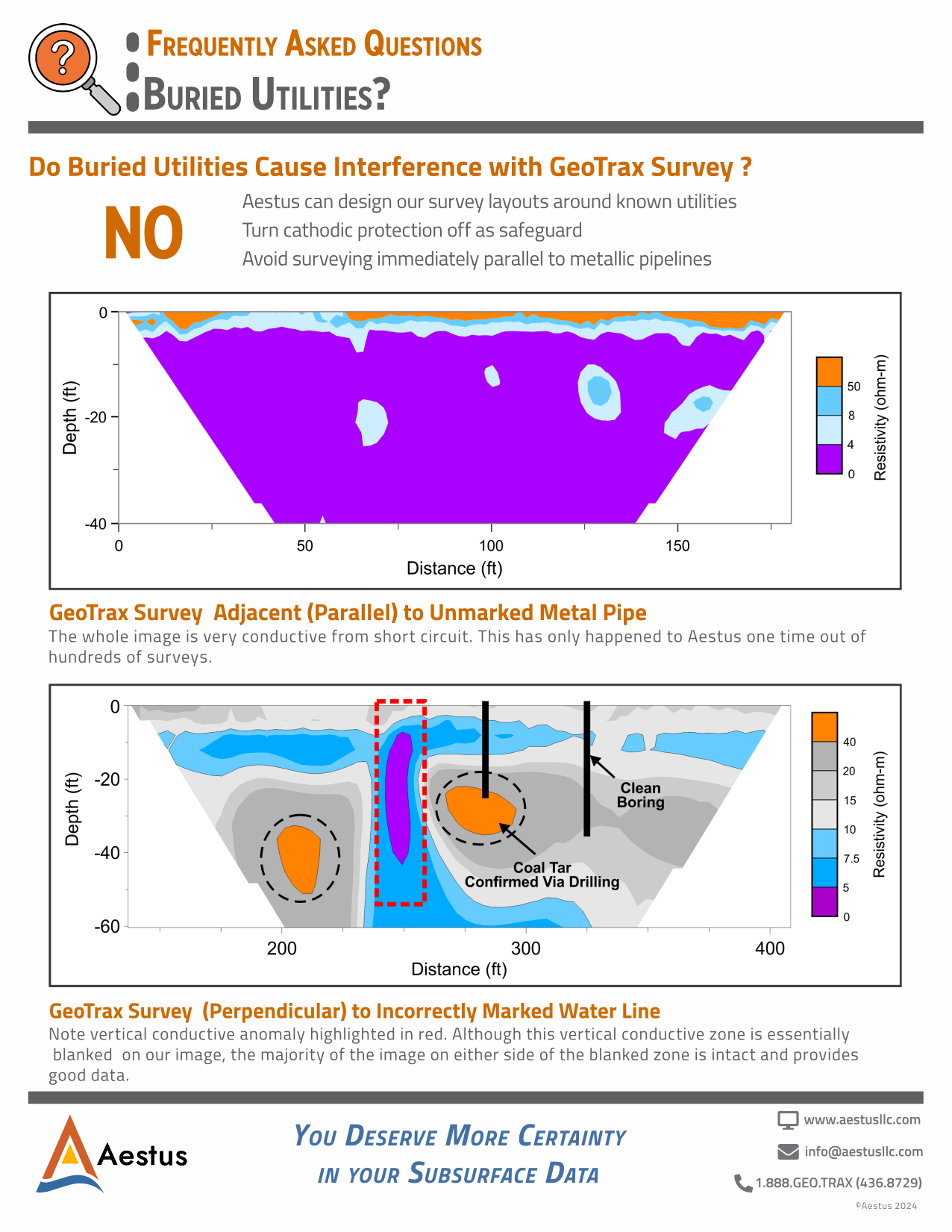
No.
We can design our survey layouts around known utilities. You should avoid surveying immediately parallel to metallic pipelines, and if possible, turn cathodic protection off as a safeguard.
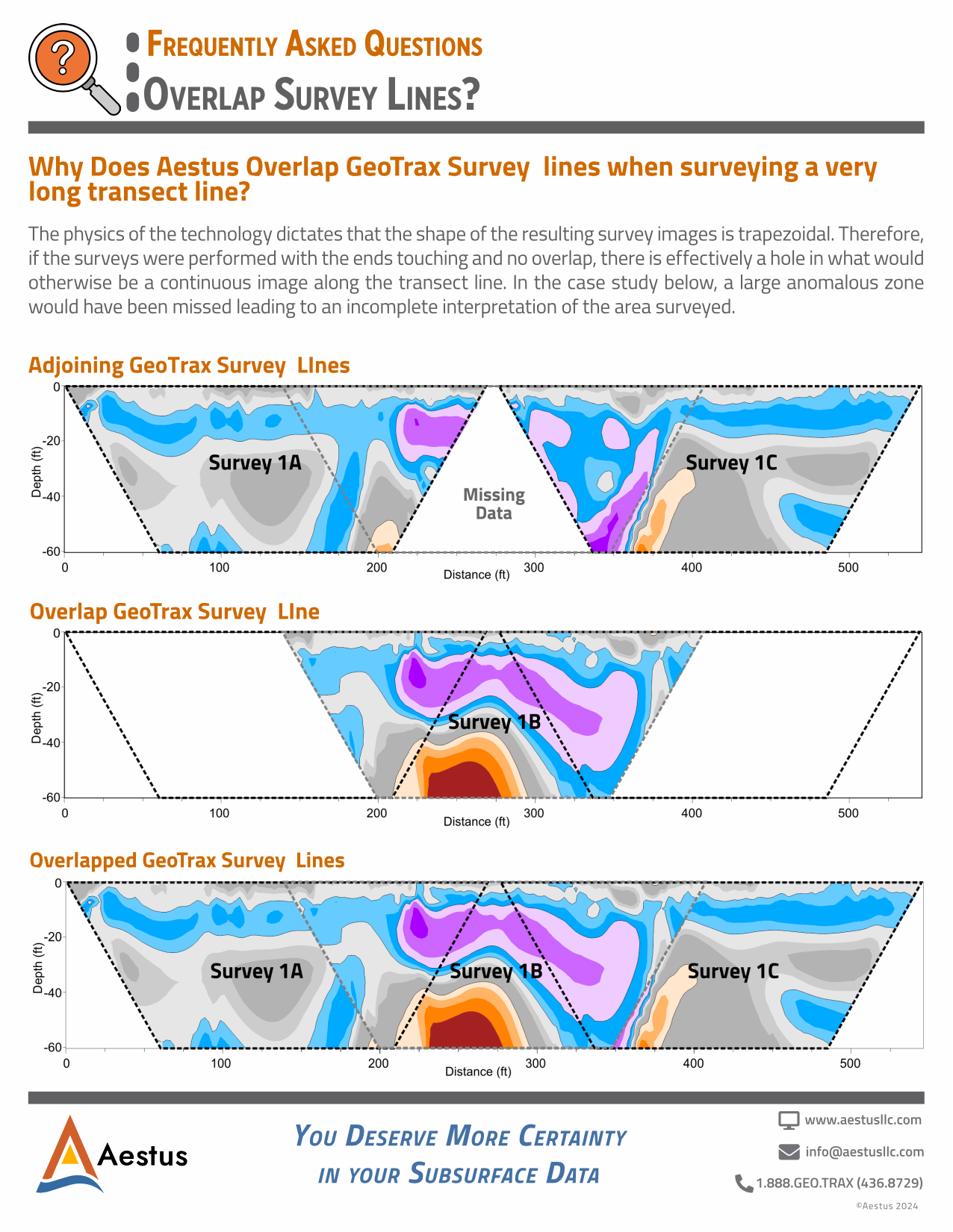
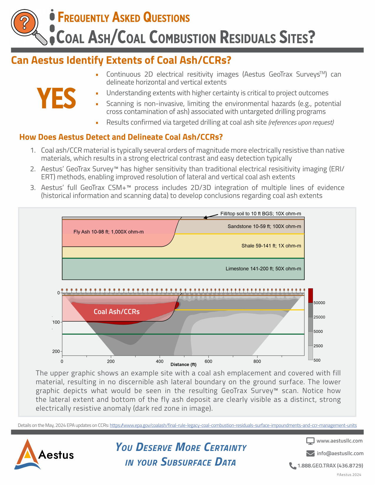
The physics of the technology dictates that the shape of the resulting survey images is trapezoidal. Therefore, if the surveys were performed with the ends touching and no overlap, there is effectively a hole in what would otherwise be a continuous image along the transect line.
Yes.
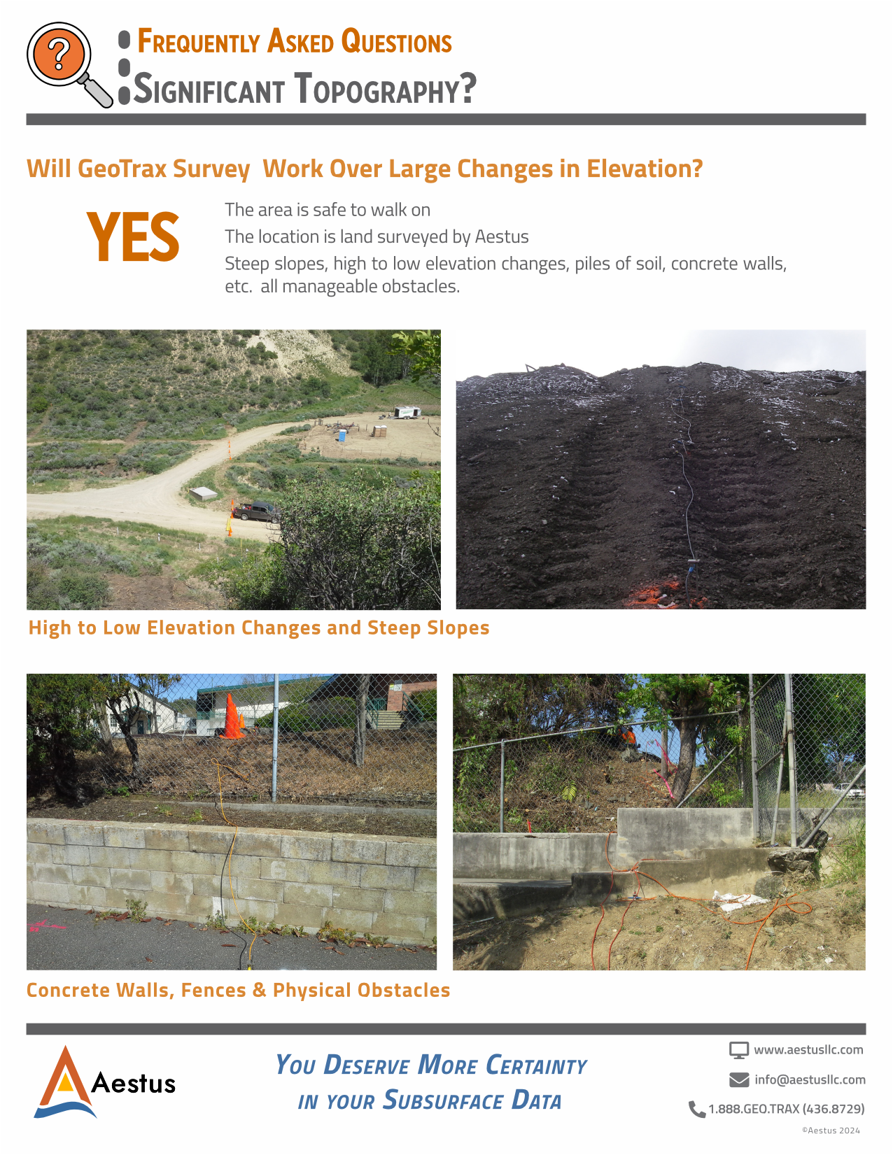
Provided the area is safe to walk on. Steep slopes, high to low elevation changes, piles of soil, concrete walls, etc. are all manageable obstacles.
Yes.
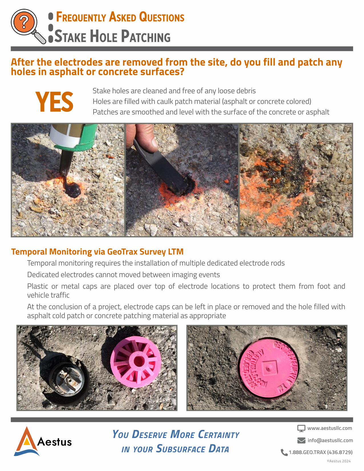
Please notify us in advance of field work if particular site material or specification is mandated. Otherwise, we will clean stake holes so they are free of any loose debris. We will fill holes with caulk patch material (asphalt or concrete colored). Finally, we will smooth patches so they are level with the surface of the concrete or asphalt.
Yes.
Particularly relative to other high-resolution site characterization (HRSC) methods. Electrode stakes are driven into the earth typically 12 to 16 inches deep, which is above most utility burial depths in theory. Aestus uses both public and private utility locating services to promote the protection of utilities and our field staff.
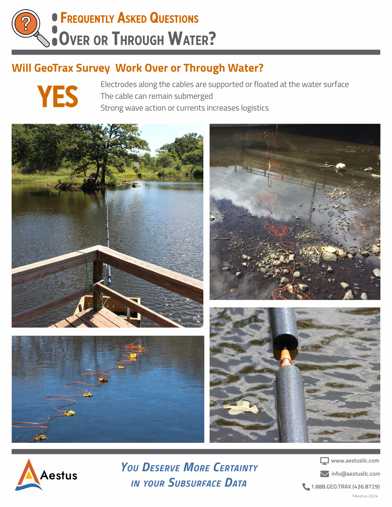
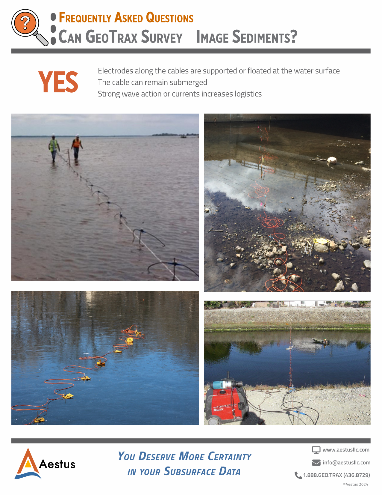
Yes.
- Electrodes along the cables are supported or floated at the water surface
- The cable can remain submerged
- Strong wave action or currents increases logistics
GeoTrax Survey™ transects consist of an electrical cable with 56 electrode stakes. These stakes are deployed in a straight line and driven 8-14 inches deep into the subsurface.
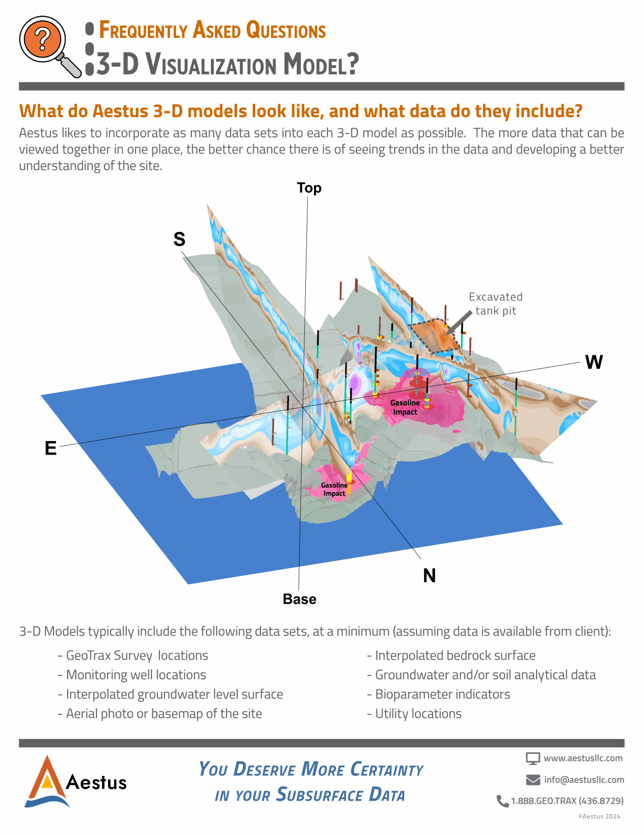
Aestus likes to incorporate as many data sets into each 3-D model as possible. The more data that can be viewed together in one place, the better chance there is of seeing trends in the data and developing a better understanding of the site.
Aestus likes to incorporate as many data sets into each 3-D model as possible. The more data that can be viewed together in one place, the better chance there is of seeing trends in the data and developing a better understanding of the site.
3-D Models typically include the following data sets, at a minimum (assuming data is available from client):
- GeoTrax Survey™ locations
- Monitoring well locations
- Interpolated groundwater level surface
- Aerial photo or base map of the site
- Interpolated bedrock surface
- Groundwater and/or soil analytical data
- Bioparameter indicators
- Utility locations
