
Have you ever tried geophysics at your site and been disappointed with the results? When it comes to locating subsurface contamination (LNAPL, DNAPL, other) or understanding preferential flowpaths, not all geophysical methods are created equal.
GeoTrax Survey™ is Aestus’ specialty electrical resistivity imaging (ERI) method which has higher sensitivity than standard ERI. It was specifically designed to successfully image subsurface contamination and other challenging subsurface conditions (e.g., karst networks). The technology improvements were developed at Oklahoma State University and are trusted by federal agencies, municipalities, and consultants as a result of peer reviewed research and successful projects worldwide.
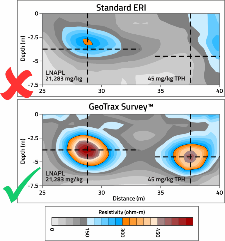
The below graphic illustrates the difference that this higher sensitivity makes: the upper image resulted from standard ERI protocols and the lower image from Aestus’ GeoTrax Survey™. Note how the left anomaly/blob in the standard image is not as strong or defined as in the GeoTrax Survey™ image and the right blob is missed entirely by standard ERI methods. Those two blobs were drilled and confirmed to be impacted by independent EPA research (https://www.linkedin.com/in/john-wilson-394264a6/.)
To learn more about the Aestus GeoTrax Survey™ difference, you can view this full FAQ.
Check out the published paper.