Aestus Poster “Electrical Hydrogeology Characterizes Groundwater Resources with More Certainty” at the Western Groundwater Congress
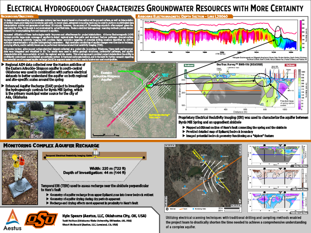
Kyle Spears, Aestus’ Technical Sales Manager/Hydrogeologist, presented a poster titled “ Electrical Hydrogeology Characterizes Groundwater Resources with More Certainty” at the Western Groundwater Congress.
Abstract:
To date, our understanding of groundwater systems has been largely based on observations at the ground surface, as well as interpolation of limited single point data from boreholes and wells. In recent years, advanced computing tools can be used to perform sophisticated data interpolations quicker and generate robust visual 3D outputs. However, the accuracy of 3D modelling outputs is often suspect given the vast majority of the 3D domain is not constrained by actual field data.
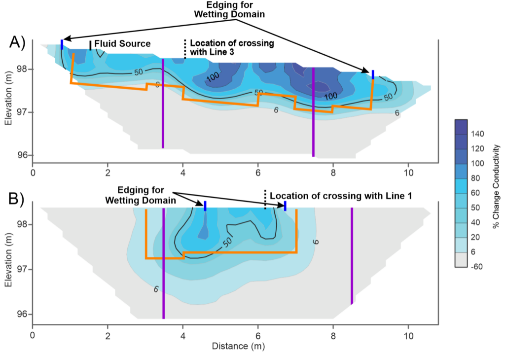
Modern electrical hydrogeology scanning methods provide denser datasets for conceptualizing flow and transport in aquifers. Increased utilization of these technologies vastly improves cost effectiveness for project stakeholders. Airborne Electromagnetic (AEM) Surveys provide large-scale coverage of aquifers to detect regional scale flow paths and dominant fracture pathways. Ground-surface deployed electrical resistivity imaging (ERI) provides higher resolution targeting of potential drilling locations identified by AEM to optimize characterization of aquifer hydrogeologic parameters. High resolution monitoring of aquifer changes over time due to recharge, pumping effects, and/or salinity issues can be performed via temporal electrical resistivity imaging (TERI).
This talk will review airborne and surface electrical datasets collected at a project site in southern Oklahoma. These static and temporal data were integrated and visualized in 3D. The results were used to define geologic structures, preferential pathways, and aquifer characteristics with more certainty at both the regional and site scales. This robust approach provided project stakeholders the ability to confidently understand a complicated groundwater system in fractured carbonate bedrock, and is the basis for further research regarding the potential use of managed aquifer recharge (MAR) to augment water supply for nearby landowners and municipalities.


